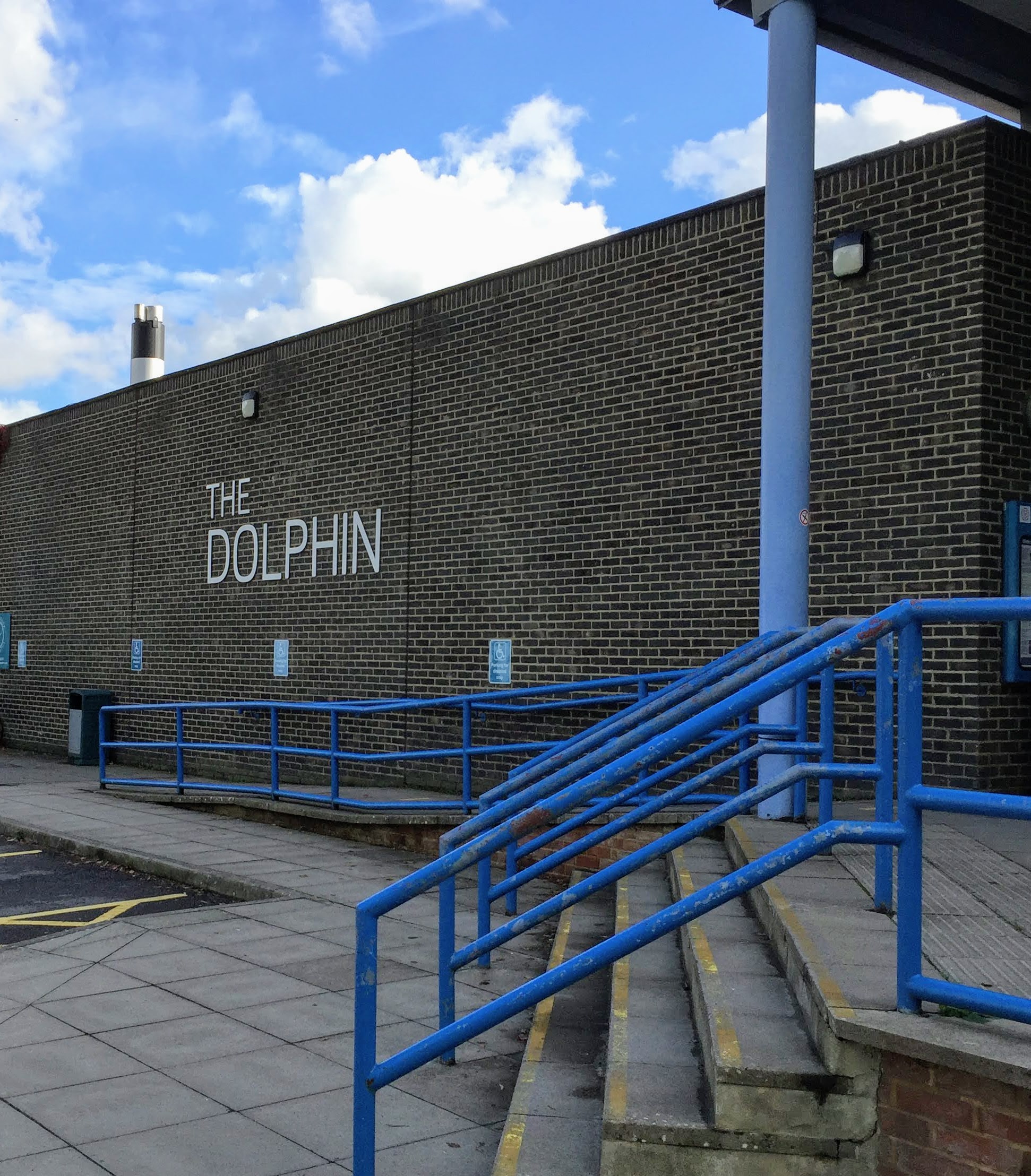
Haywards Heath VIII (walks)
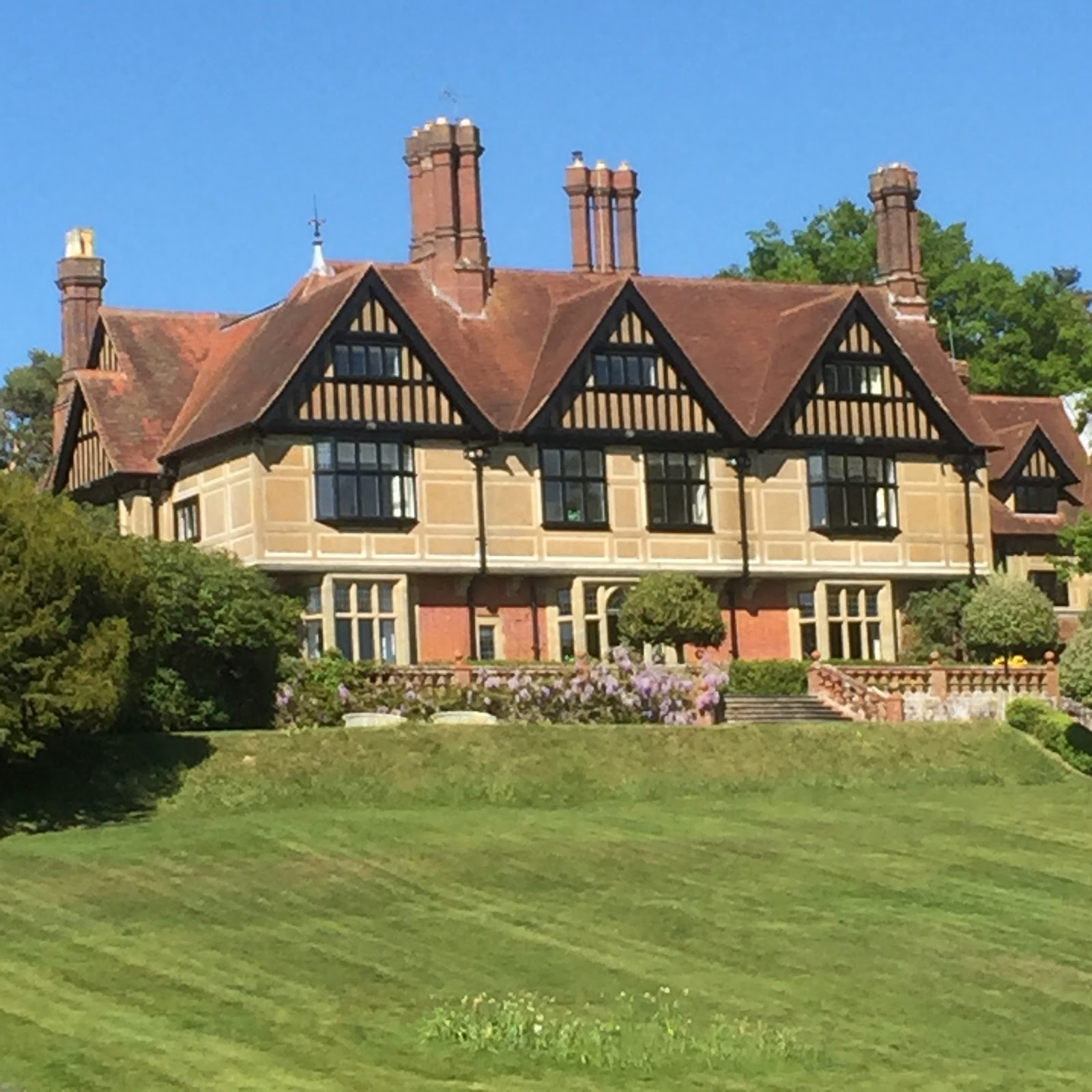
Abbots Leigh house (1892) built by an aide of Queen Victoria recalls a village near Bristol and a hymn tune composed there in 1942 by villager Cyril Taylor for ‘Glorious Things of Thee Are Spoken‘ to replace use of the German national anthem. It is a hidden treasure of Haywards Heath with a facade visible only from the footpath which circles the estate. That footpath descends from Lewes Road to the right of North Colwell Barn opposite the path up from Lyoth Lane via Cobbetts Mead. The woodland path past the Barn opens into a large well mown meadow. Follow the path down through the fields as it curves round Abbots Leigh revealed in all its splendour to viewers on the path in the bottom field. After enjoying the view enter the wood and continue through to enter Slugwash Lane opposite Cottage of Content. Turn left to walk up Slugwash Lane to Lewes Road. Turn left again to walk along the verge before crossing the road into Snowdrop Lane then left back down to Lyoth Lane. At the bottom of the lane cross Gravelye Lane to pass down the track diagonally opposite into Haywards Heath’s America Estate.

The second Church of the Ascension in Vale Road was dedicated 1966. The first was an iron building in St John’s Road erected 1895 ‘to cater for the Asylum area taken over from Wivelsfield’. It was demolished and the congregation re-sited as St Edmund’s Church at the former Congregational Church on Wivelsfield Road (picture from 1908) moving on to the new build Ascension Church. They left a building now serving as Haywards Heath Islamic Centre with a gallery assisting separation of men and women in Muslim worship. This history reveals something of church development and the diversification of faith in the town over the last century. Why not take a stroll down Sussex Road to view the white painted Mosque normally open daily to all for prayer? You could head then for where its former congregation settled by turning right into Edward Road and then left into Vale Road where Ascension Church will come into view. Continue past the Church curving right into Sheppeys. After passing the entrance to Ashenground Woods proceed up Sunnywood Drive. Turn left at Drummond Close then walk across Victoria Park with its view of St Wilfrid’s, mother Church of the Ascension, and turn right for Orchards.
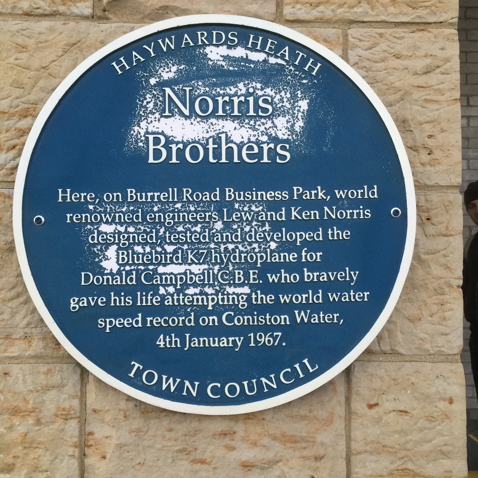
Lew and Ken Norris and Donald Campbell have a plaque in Burrell Road outside the former Norris House. This commemorates the brothers’ pioneering work on jet engines including Bluebell K7 and Donald Campbell who attempted to break the water speed record in this hydroplane with fatal consequence 4 January 1967 on Coniston Water in the Lake District. Older residents recall letters apologising for jet noise as Bluebird was tested 1966 in Burrell Road. To view the plaque walk down from Sainsbury’s bus stop continuing on Bannister Way and take a first right down Burrell Road to Flowserve on your left. The Norris Brothers and Donald Campbell blue plaque is affixed to an entrance pillar. Though quite new it had sustained some erosion when I took this picture earlier in the year. If you want a longer walk continue along Burrell Road which curves left. At the junction turn left on the pavement besides Balcombe Road then first right along Old Wickham Way. Cross the railway bridge and walk on past Wickham Farmhouse, a site dating back to the 13th century. Go straight ahead into a narrow footpath that passes in front of Sunte House occupation of which can be traced back to 1522. The footpath emerges at a mini roundabout where you can head back into Haywards Heath along Summerhill Lane.

Haywards Heath owes an immense debt to the heart for social renewal possessed by William Allen (1770-1843) who founded the town’s America estate. Allen was a man of many parts, scientist and pharmacist, educationalist and prison reformer, pacifist and slavery abolitionist. He established a ‘home colony’ off Gravelye Lane to build self-sufficiency and empower agricultural workers from Lindfield. This was when people recalled the poor being sent across the Atlantic to what had recently become Britain’s former colony. Haywards Heath street names recall Allen’s contribution through the America estate. It’s an interesting walk from Bentswood recreation ground up America Lane and Westlands Road to The Hollows on the right. Pass beside No 2 which passes the side of William Allen House noting the mounting block outside Gravelye Cottage on the other side. At the top turn left and left again into Gravelye Close where William Allen’s former residence aka Gravelye House is on the left. Continue down Gravelye Road and take the second left down William Allen Lane. Enter Scrase Valley Reserve at the bottom continuing with the stream to your right. Turn left at the junction walking up and across to Barn Cottage Lane and the recreation ground.

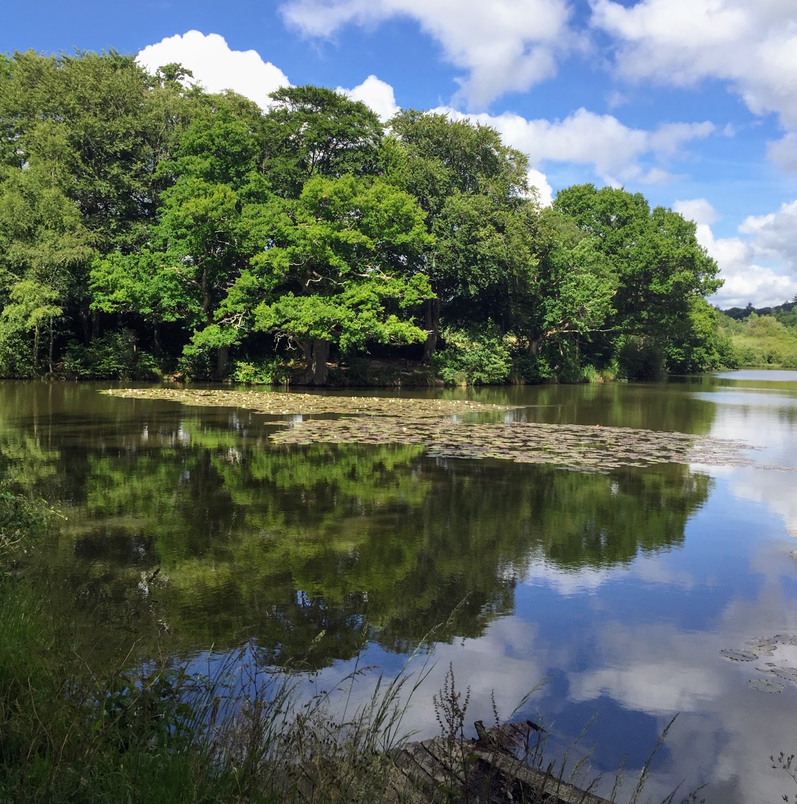
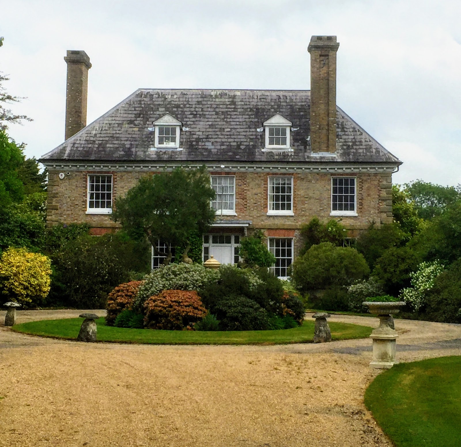
A five mile circular walk from Haywards Heath takes in historic Paxhill Park mansion (1606). From Bentswood head through the woods to Lindfield recreation field and cross aiming in between the seats off Lewes Road. Cross ditch and road to enter Eastern Road turning left up Luxford Road and then Barncroft Drive. As the Drive veers right turn left into the footpath. Continue straight ahead with a large field on your left until the T at a fence. Turn right and continue straight across the concrete road over the style and down the field. Cross the bridge into another field following the path right alongside the River Ouse. At the road cross and view the weir and pond. Turn left and after the manor enter the footpath on your left which passes in front of Lindfield Golf Clubhouse. Follow the path which exits the Golf Course over a bridge. Turn left up the field through one gate then another by the house into the signed footpath. Walk on as the park opens up before you and the turreted splendour of Paxhill Park mansion to your right. Head left along the footpath down the meadow continuing to the road. Turn left to head back to Haywards Heath through Lindfield village.

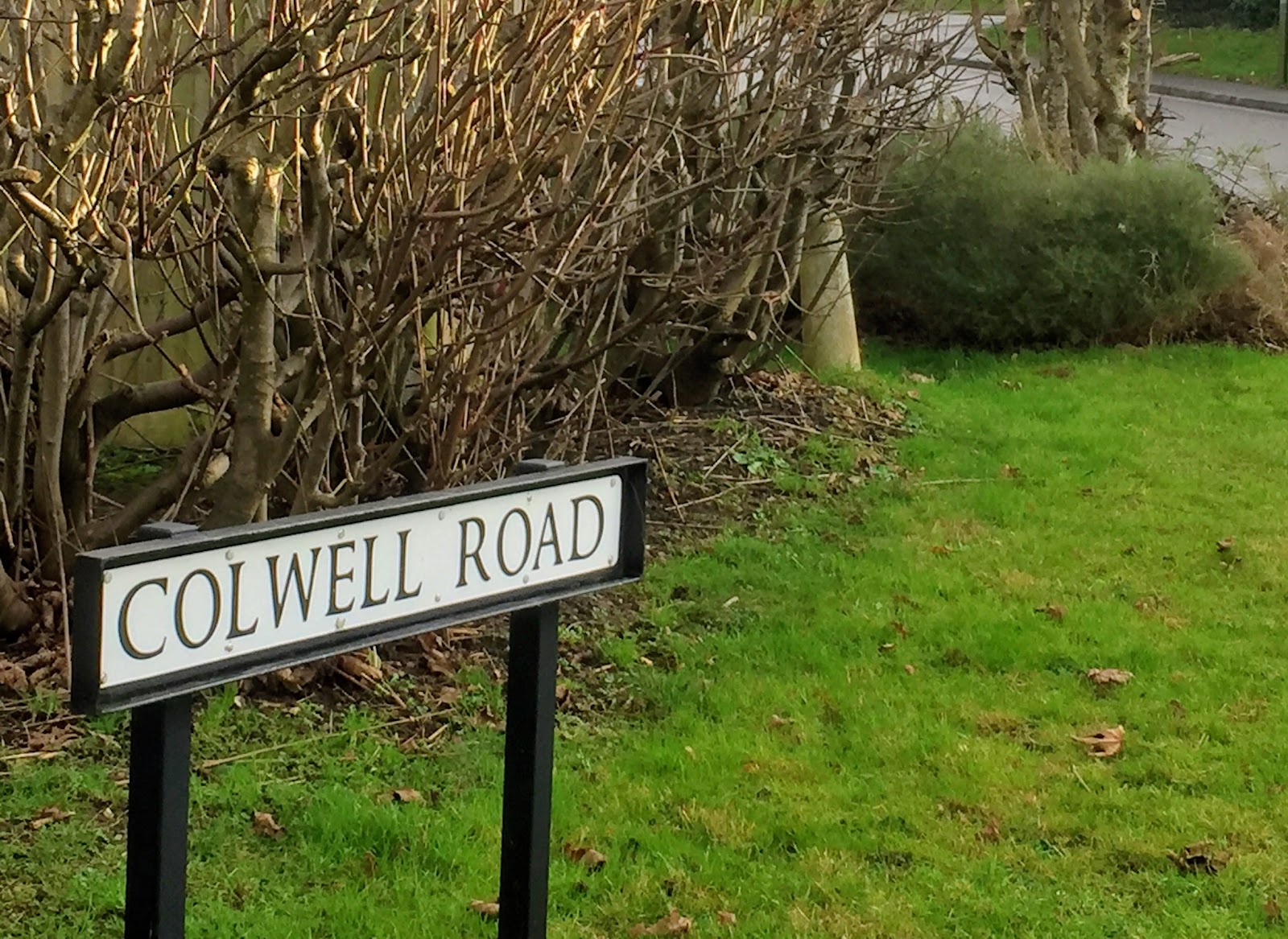
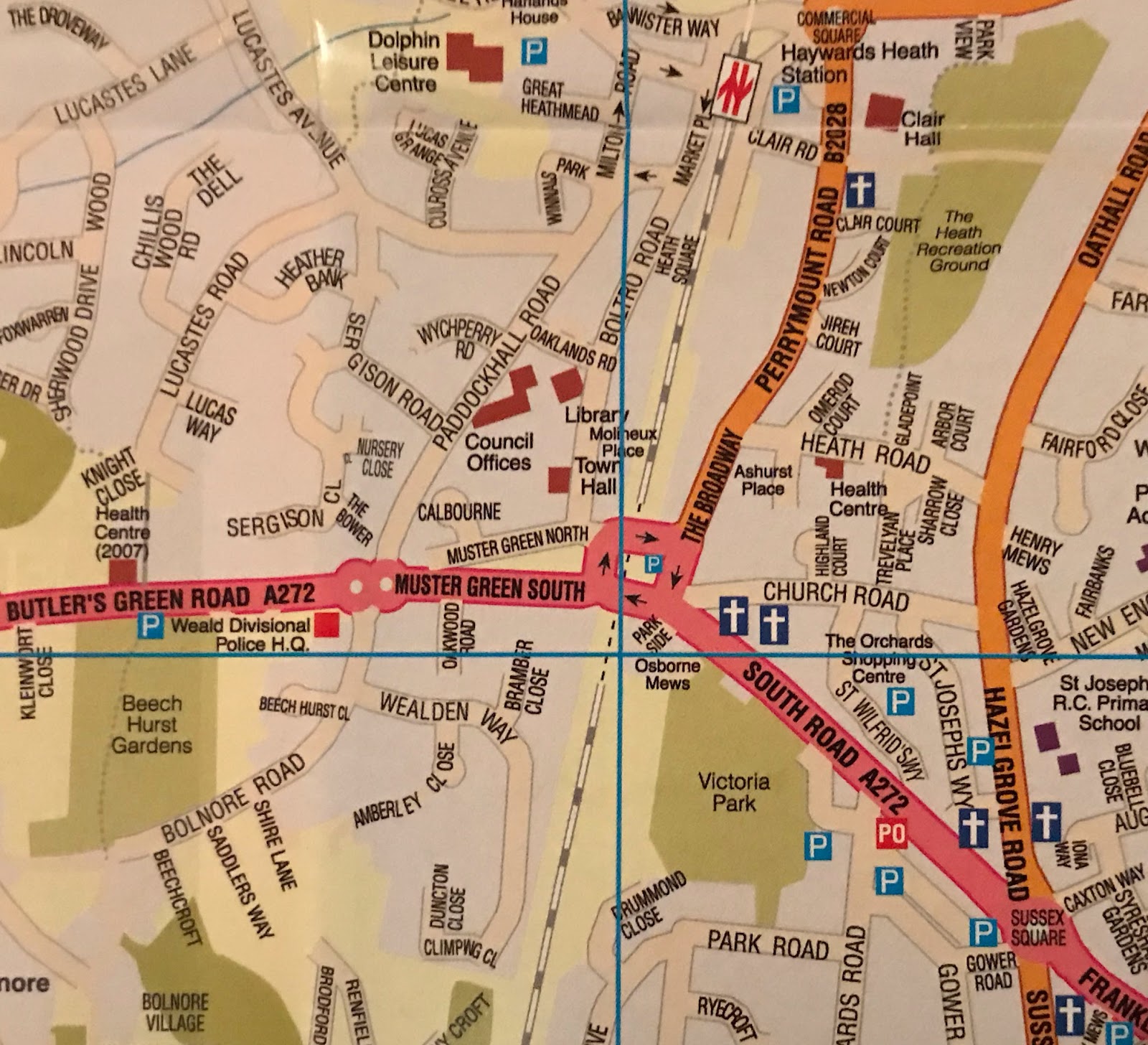
There’s a good circular walk to the old hospital from Orchards precinct left along South Road, after the roundabout along Franklynn Rd. right into Triangle Rd, and immediately left to proceed up Kents Road into the path at the top of the road into Colwell Gardens leading to Colwell Road and Southdowns Park. The railway’s arrival in Haywards Heath at the centre of Sussex made it the obvious venue for what was initially called the County Lunatic Asylum constructed during the 1850s. The hospital, designed by Henry Kendall in Italianate style with corridor layout, became known after the introduction of the National Health Service as St Francis Hospital. Treatment of mental illness in Victorian times differs so much from our day with isolation seen as the key for fear almost of contamination. Haywards Heath Asylum broke new ground in treating mental illness through pioneer Doctor Lockhart Robertson who used vapour baths to soothe his patients. The creation of the hospital south of the town made Haywards Heath the shape it is, reaching down south east from Cuckfield to Wivelsfield without an obvious centre. After touring the estate across the road with its splendid view of the South Downs re-enter Colwell Road. Turn left to return to Orchards via Wivelsfield Road which gives way to Sussex Road and, after the roundabout, South Road.
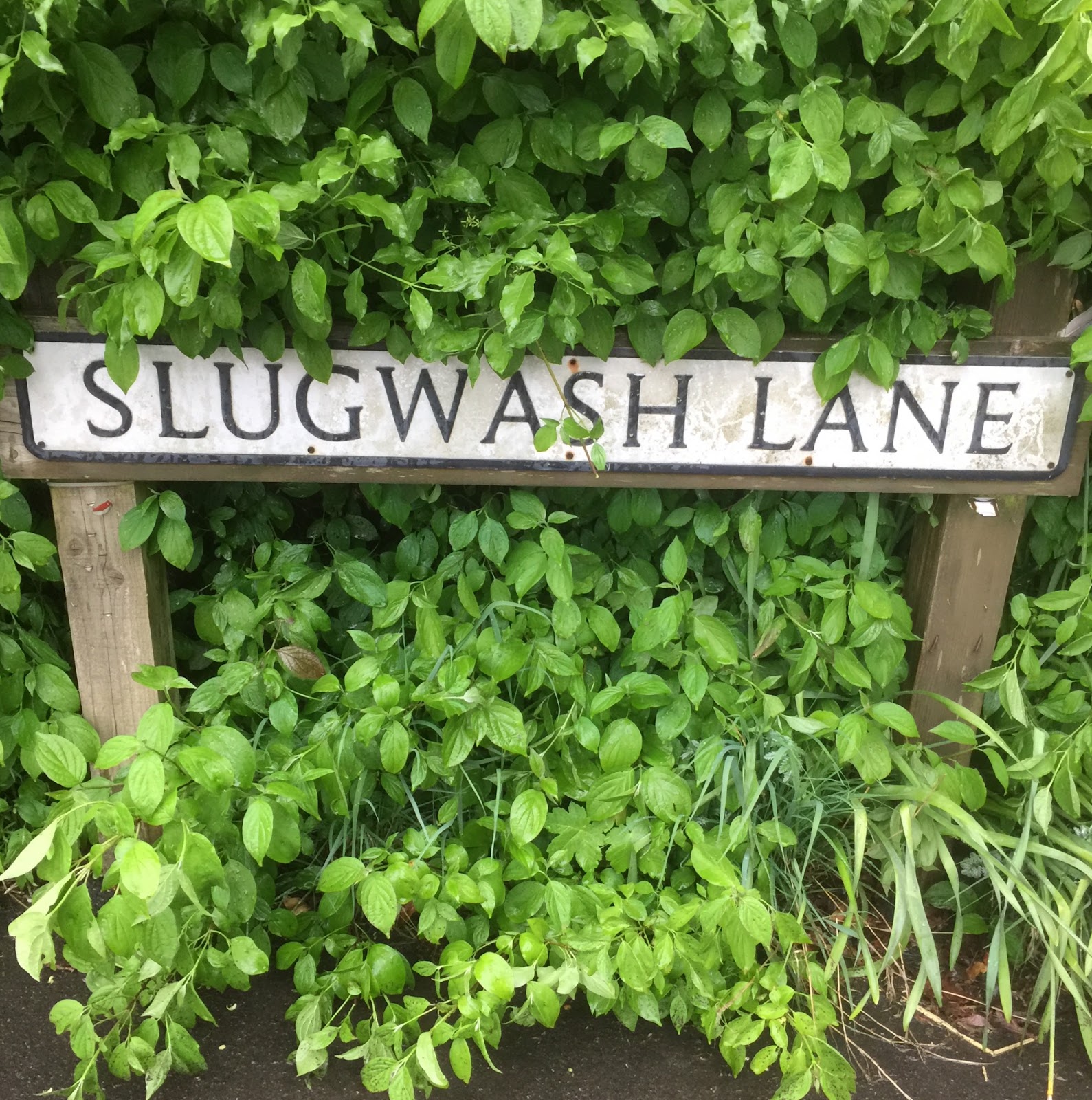
Have you ever walked down Slugwash Lane? As the M25 skirts the North Downs south of London and the A27 skirts the South Downs and Brighton the A272 traverses the ancient home of Haywards Heath, the High Weald of Mid-Sussex. Heather Warnes 2009 history observes that ‘it was common in this part of Mid Sussex for early estates to be laid out across a ridge top, the north-facing slopes often being reserved to the lord for wood and timber’. The heath was open land facing south benefitting both from the sun and drainage of water from the rock underlay of the High Weald down to the southern claylands. Slugwash Lane descends from our High Weald to Wivelsfield’s Low Weald with the South Downs on the horizon. To get to Slugwash from Orchards head left along South Road then at the roundabout go down Caxton Way. Turn along Syresham Gardens then left along Priory Way to Western Road. Turn left and cross the road into the footpath down to the left of the Cemetery gates. Continue straight at the bottom of the graveyard which continues to the right of the stream into The Hollow. Continue and ascend the track at the top of the road beside No 2 up to Gravelye Lane, turn right and cross the road into Lyoth Lane. Continue up the steep narrow road to Snowdrop Lane, turn right and walk to Lewes Road. Cross the road. Turn left to walk along the verge turning right after a distance into Slugwash Lane.
The Mid Sussex District Council sign in Blunts Wood reads: ‘Most of the oak trees … are English Oaks providing habitat for more than 280 species of insect, food for birds and other predators. Cavities in the trees are used by nesting birds and bats. Oaks have been held in high regard in most European cultures for centuries and were linked to Gods of thunder and lightning. Oak trees are taller than many other trees so are frequently hit by lightning’. A walk to Cuckfield village through Blunts Wood from Haywards Heath might start opposite the railway station at The Burrell Arms (1871). The Arms reproduced on the pub wall are those of Cuckfield landowners based at Ockenden Manor and are seen also in Cuckfield Church Lady Chapel. They include a graphic arm waving a branch. To reach Blunts Wood walk past the garage under the railway looking right just after the bridge at the inclined track beyond the metal gate used years back for animals to ascend from market to the cattle trains. Cross in front of Sainsbury’s heading along Bannister Way, Harlands Road, Bluntswood Road and Crescent to enter Blunts Wood at the car park. You continue in the same direction through the wood and Paige’s Meadow exiting onto Hatchgate Lane where you can catch a 39, 89 or 271 bus back to town opposite The Wheatsheaf pub.

In lockdown I discovered a circular walk from Haywards Heath to Borde Hill Gardens where I took this picture from the path along its boundary. I walked from my home in Bentswood via Lindfield recreation ground up Lindfield High Street past All Saints Church and turned left before the right bend entering the footpath running behind the houses onto Finches Lane then right through the woods to a junction with the road into Kenwards Farm. Turning left to the main road and crossing into the wood straight up the path which follows the edge of the field led me onto Copyhold Lane. Turning left I continued to the road junction and turned left for 200 yards then right past Borde Hill Gardens entrance continuing on the track. I turned left following the road through Stone Lodge to cross Hanlye Lane in Cuckfield and turned right then left at the roundabout. I turned left across the grass after the bus stop to enter the path to the right of the housing. I walked down to the metal gate and entered the field followed the footpath signed half right down to a standing T junction signpost and turned right. Going through the gate and headed left down the field towards the barn-like building at Horsgate Farm. I crossed the style and continued past that building walking along Horsgate Lane emerging opposite the Wheatsheaf Pub. I turned left and left again down Hatchgate Lane walking straight ahead eventually through Blunts Wood and back to Bentswood.
Here is one of the lakes in Horsted Keynes famous for its Grade I Norman Church of lavish proportions, the volunteer run Bluebell Railway and its association with former Prime Minister Harold Macmillan (1894-1986) buried in the Churchyard. President Kennedy visited Macmillan in the village. Margaret Thatcher attended his funeral. Less well known are two 17th century writers. Archbishop Robert Leighton (1611-1684) whose altar tomb lies outside the south wall near the side door is a saint in the Anglican calendar famed for biblical commentaries and large hearted spiritual vision. Rector Giles Moore’s tomb (d1679) is less evident but his writings are also read today. ‘Giles Moore’s Day Book’ is available on the internet providing a day by day record of the life of a country priest through receipts, payments and journeys in Horsted Keynes 1656-1679. The village is an easy five mile walk from Haywards Heath via Walstead walking past East Mascalls Farm and the Paxhill Park Golf Course to the wood. Leave the road ascending the path to your right leading into a large field. Cross the field back to the road along which the path continues briefly to Cockhaise Farm. Turn left here along a track. Take a half right turn along a footpath which descends to cross Bluebell Railway and then skirts below Tremaines Manor to the road. Turn left and walk into Horsted Keynes. Take the 270 bus back to Orchards.

Nasty experiences with highwaymen on Haywards Heath, the ‘hoth’ or wasteland outside Cuckfield and Lindfield, are part of folklore to the extent of the seeming invention of a fearsome Jack Hayward who once ruled it to whom you had to ‘stand and deliver’! This romantic legend got under the collar of a Vicar of St Wilfrid’s who put in an unsuccessful bid to rename the new town ‘St Wilfrid’s’. The legend is dispatched by references to Hayworth Hoth going back to the 13th century. Hayworth derives from old English words about an enclosure of land and there is 17th century evidence for this enclosing. There is a small portion of the ancient heath near the town centre aka Clair Park accessed from Orchards car park across Church Road down the footpath next to the carpark, into Trevelyan Place. At Heath Road, cross and follow the footpath descending through the ancient heath to Clair Hall, across from the railway station which opened in 1841. The arrival of the railway made for the growth of Haywards Heath as a town since, with the adjacent A23, it opened up the possibility of living in the attractive heart of Sussex whilst travelling to lucrative work in London, Brighton, Crawley and Gatwick airport. Each morning and evening the heath sees a busy flow of commuters heading to and from the railway station. Continue your circuit of the heath returning the way you came via the footpaths to Church Road and Orchards.
Sunte House has become better known through Sunte Close, the recently built housing associated with it and now providing direct access from College Road. By popular acclaim Wyn K.Ford & A.C. Gabe ‘The Metropolis of Mid Sussex’ is the most authoritative history of Haywards Heath. Chapter 2 of Ford & Gabe has the fine coloured 1638 map of lands belonging to Nicholas Hardham on its cover. On p9 the authors overlay a copy of that map on one from 1981 showing no less than 19 sites including Sunte House where part or all of the original building still exists. I’ve visited all of these sites which makes for a good day out. You access the House from College Lane along Sunte Close, along Birchen Lane or on foot by going under the railway bridge along Balcombe Road and turning right along Old Wickham Lane past Wickham Farmhouse into a narrow footpath that passes in front of the house. Alternatively you can take the footpath from the mini roundabout joining Summerhill Lane, Gander Hill, Portsmouth Lane and Sunte Avenue. The Grade II listing of Sunte House describes it as an ‘L-shaped building of 1700 with C18 laundry extension of 1 storey red brick with Horsham stone slab roof and metal casements. The Interior contains early C18 principal staircase of elm.’ Local records can trace residence at Sunte House back to 1522.
By the 1850s All Saints, Lindfield cemetery was so full new burials had to be made on top of old explaining the raised ground in the northern part of the churchyard. Recognition of the health risks of this led to a decision to build a new cemetery at Walstead, a mile across the fields to the south east. The new cemetery recognised religious diversity in providing mortuary chapels for both Church of England and Nonconformist use. My ‘cemetery’ tour starts by descending the footpath down to the left of Haywards Heath cemetery gates on Western Road . Continue straight at the bottom keeping to the right of the stream into The Hollow where you ascend the track at the top of this road beside No 2 . At the top of the track turn right along Gravelye Lane and cross to enter Lyoth Lane. Take the second turning before the stream into the housing estate and follow the footpath along Trefoil Avenue keeping the houses to your left enjoying the woods and fields to your right. Continue along the footpath and estate roads which exit onto the B2111 at Scamps Hill. Turn right and then left at the road junction walking past Walstead cemetery. At Snowflake Lane turn left to Walstead Forge where the road narrows into a footpath. Continue in the same direction to the footpath junction taking the left turn towards All Saints, Lindfield cemetery. Catch a 30, 270 or 272 bus back to Haywards Heath from opposite the Stand Up Pub.

Ardingly College boarding and day independent school has a pelican on its logo. Pelicans feeding their young from their own blood are in Christian symbolism pointers to the eucharist central to the Anglo-Catholic tradition of schools such as Ardingly, Hurstpierpoint and Lancing in Sussex which are members of the Woodard Corporation. The Chapel and its Bell Tower are prominent on the High Weald sky line visible to railway passengers crossing Balcombe Viaduct to and from London. In turn pupils at the School profit from the inspirational views provided from the thoughtful location of the school buildings. Old Ardinians include satirist Ian Hislop, actor Terry Thomas and Formula One World Champion Mike Hawthorn. My walk to the College heads past the fire station crossing College Road then up Wickham Lane and across the fields and golf course to Copyhold Lane. Across the Lane diagonally to your right is the footpath to Ardingly Reservoir where you turn right along the road then left past Ardingly College Pre-Prep and Nursery School. Turn right at the grass island heading up to the main school. The footpath passes in front of St Saviour's Chapel then crosses the main road to the right of the house and sports facilities into the wood. Continue straight ahead. Exit the wood crossing the meadow to the footpath junction sign. Turn left and walk in the same direction to Ardingly where you catch the 272 bus back to Haywards Heath at the Hapstead Hall bus stop.
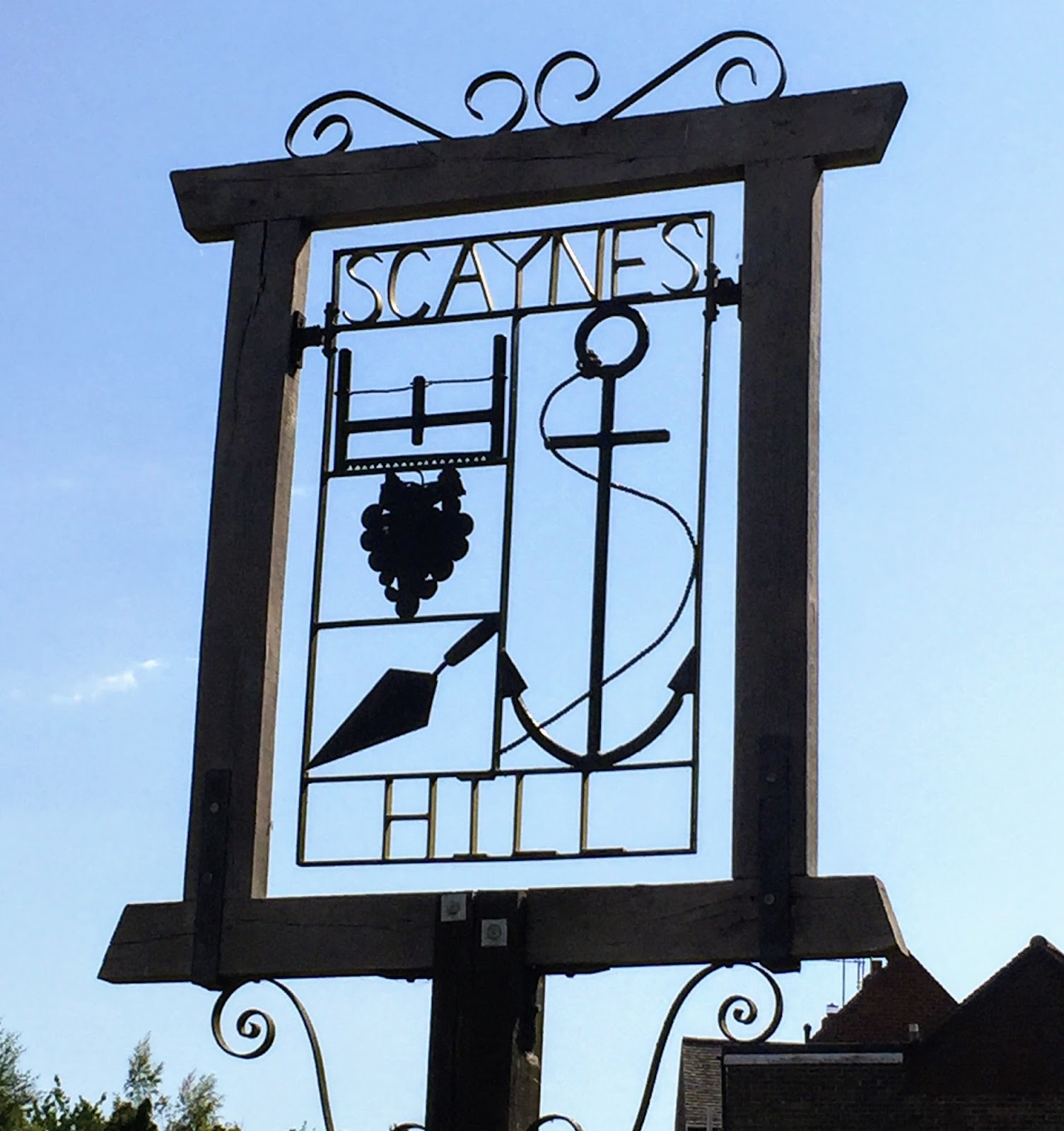
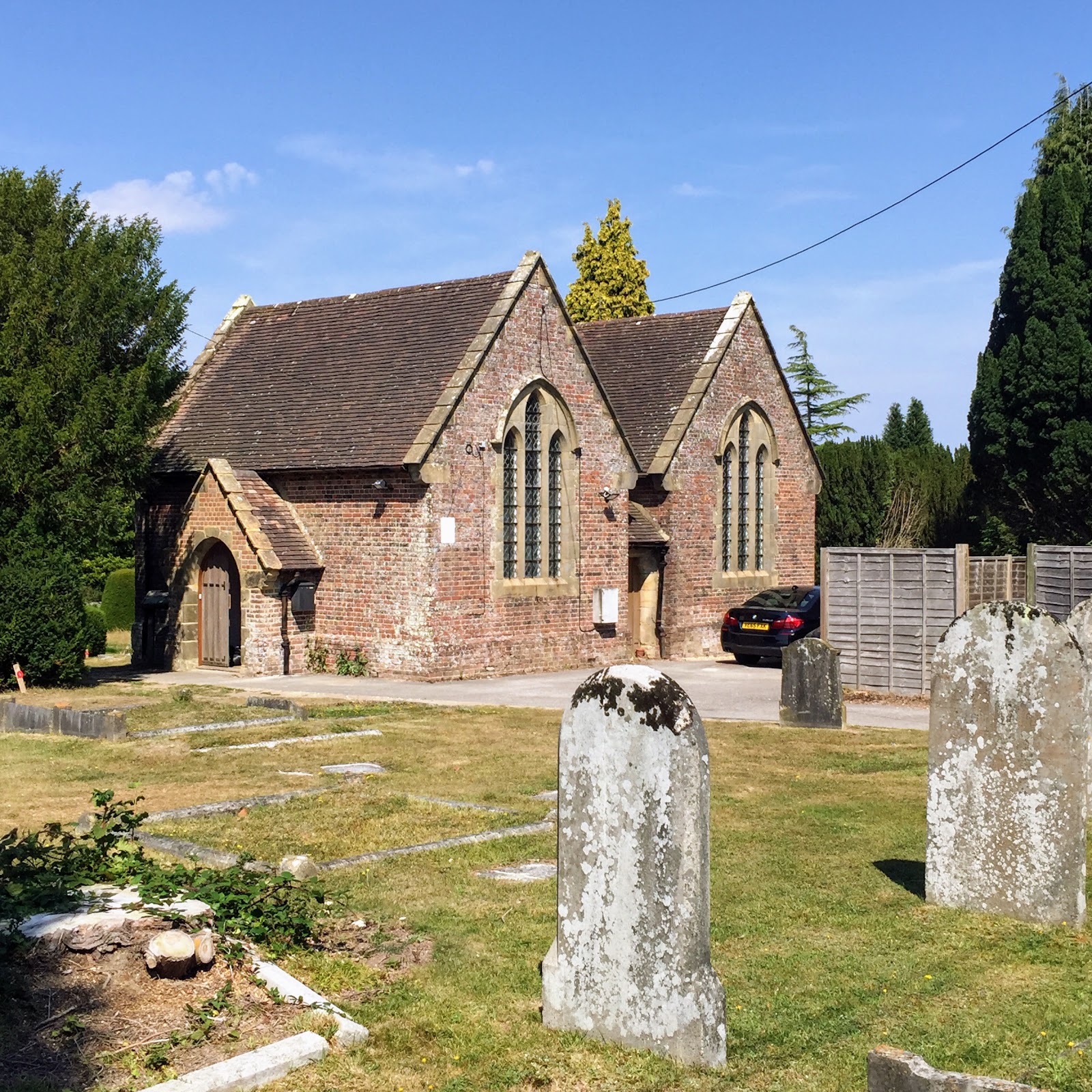
Scaynes Hill like Haywards Heath lies on high ground which attracted early settlement on account of good drainage. The A272 running through the village continues from Winchester to Heathfield, sometimes called the pilgrim route to Canterbury. Scaynes Hill Church is dedicated to St Augustine of Canterbury. Local history is symbolised on the 1977 Queen’s Jubilee Village sign with anchor, trowel, saw and bunch of grapes. The Farmers pub (1751) was once known as ‘The Anchor’ from a holding place at the top of the hill helping haul loads up the steep road. The trowel and saw signify the old village builders and saw mill and the grapes Rock Lodge vineyard. A favourite walk starts by descending the footpath down to the left of Western Road Cemetery gates. Continue straight ahead at the bottom of the graveyard which continues to the right of the stream into The Hollow. Continue and ascend the track at the top of the road beside No 2 up to Gravelye Lane, turn right and cross the road into Lyoth Lane. Continue up to Snowdrop Lane and turn left walking on to its junction with the B2111 Lewes Road. Cross diagonally following the footpath sign through into a narrow path along a field. At the end enter a farm track continuing to a style. After the style, enter a large field and cross straight ahead to enter the wood. Follow the footpath through the woods leading up to Scaynes Hill where you catch the 31 Uckfield bus back to Orchards.
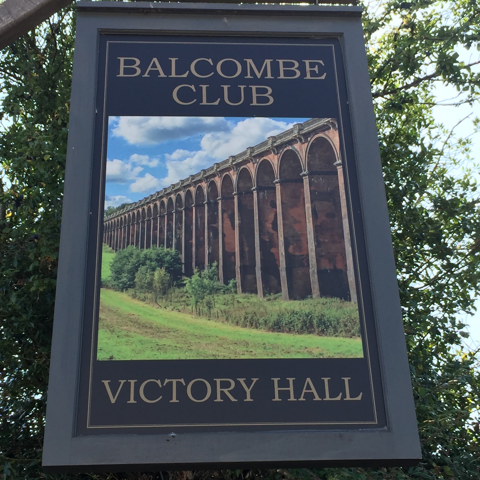
Like Haywards Heath, Balcombe gained fame through the London-Brighton railway which required a viaduct to cross the River Ouse Valley. The viaduct, completed 1841 in Italianate style, has 11 million bricks which were carried by barge along the Ouse from Scaynes Hill. This process required construction of canals to avoid bends in the river as alongside The Sloop Inn at Scaynes Hill. The arches were tapered to reduce the number of bricks needed in construction, an impressive sight from under the viaduct. Balcombe village, surrounded by woods and lakes, has the beautiful St Mary’s Church and a good number of listed buildings. My favourite walk to Balcombe heads past Haywards Heath Fire Station crossing College Road then up Wickham Lane and across the fields and golf course to Copyhold Lane. Across the Lane diagonally to the right is the footpath through River’s Wood after which you can see the viaduct on the ascent to the Reservoir where you follow the waterside walking trail to Balcombe. At the end of the trail continue left along the road over a bridge and after this take the stepped footpath on the left. At the top continue straight up the field on the left of the wood then through a gate into a bridle path to the road by Barn Meadow. Cross and turn left along the pavement. Take the first right along Oldlands Avenue continuing to the cutting on the left down to the main road. Descend to Balcombe Station returning by train over the viaduct to Haywards Heath Station.
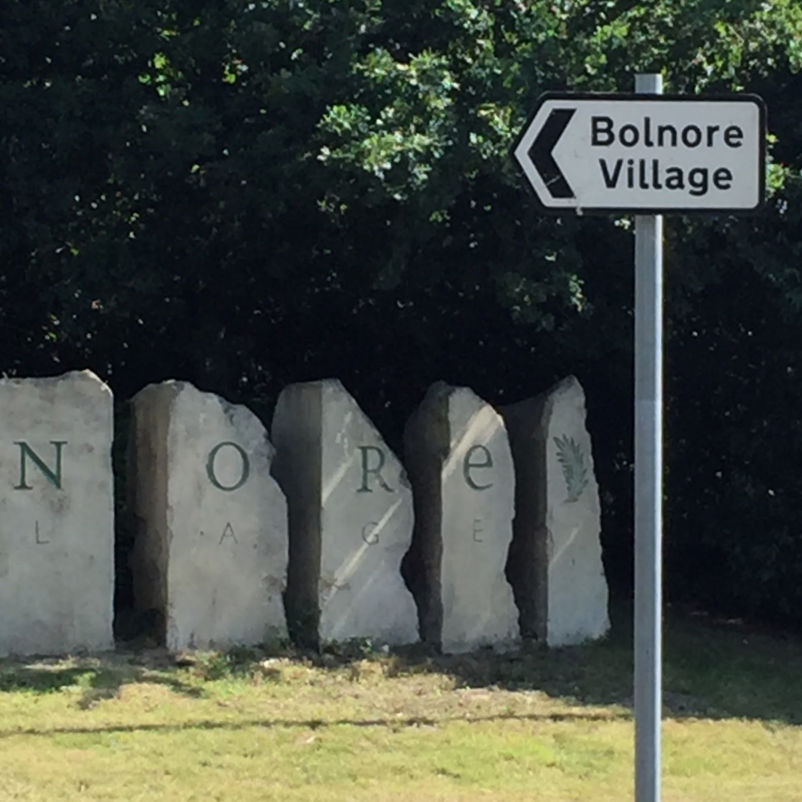
Housing is a hot potato in Sussex with so much beautiful countryside protected from development by law. In the late 1990s permission for expanding Haywards Heath to the south west was granted with the first houses in Bolnore Village completed 2002. Since the Ashenground and Catts Woods were a Site of Nature Conservation Interest this development was controversial. As a condition the developers had to build Haywards Heath by-pass as a relief road benefiting the town. This re-routing of the A272 was completed in 2014. A striking 1638 map published by Haywards Heath Society was used in Stuart Meier’s 2006 submission to the Bolnore Village Planning Inquiry as evidence ‘that certain wooded parcels have ancient woodland continuity, and the effects of development should be mitigated in an appropriate manner’. How much that was achieved can be judged on this walk to Bolnore Village. Walk down Victoria Park and exit the bottom south west corner into Drummond Close. Walk along the Close then turn right proceeding down Sunnywood Drive to the first junction. Turn right into the ancient Ashenground Road (here named Keymer End) which provides access into the woods of that name. After crossing the railway bridge turn sharp left and walk on the path nearest to the railway until you see the small bridge on the right. Cross and follow the pathway through the trees into the village. Behind the Market Square, catch a 33 or 39 bus back to town.

The River Ouse skirts Haywards Heath on its way from Lower Beeding to Newhaven. In 1978 following expansion of the local population with increased demand for water it was decided to dam Shell Brook, tributary of the Ouse, and create Ardingly Reservoir. With capacity over 5000 million litres it is filled with water pumped from the Ouse when it flows high. The Reservoir Centre facilitates water sports including windsurfing, canoeing, powerboating and dinghy sailing. Viewing the water level is a walker’s hobby. A walk to Ardingly Reservoir is signposted on College Road up Wickham Lane going across the fields and golf course to Copyhold Lane continuing across the Lane diagonally to the right through River’s Wood where the footpath crosses the disused line from Haywards Heath to Ardingly of interest to Bluebell Railway. On arrival at the Reservoir take advantage of the refreshments bar at the Activity Centre. Walk along its bank and at the end turn left into the Reservoir walking trail entering a wooded section. After this take a right turn going over a style. Walk up the fields into Church Lane, Ardingly. At the top of the Lane on the left view Grade 1 listed St Peter’s Church, built 14th century in the Decorated Gothic style. Turn right and continue to the Hapstead Hall bus stop at the end of the road for the 272 Orchards bus.
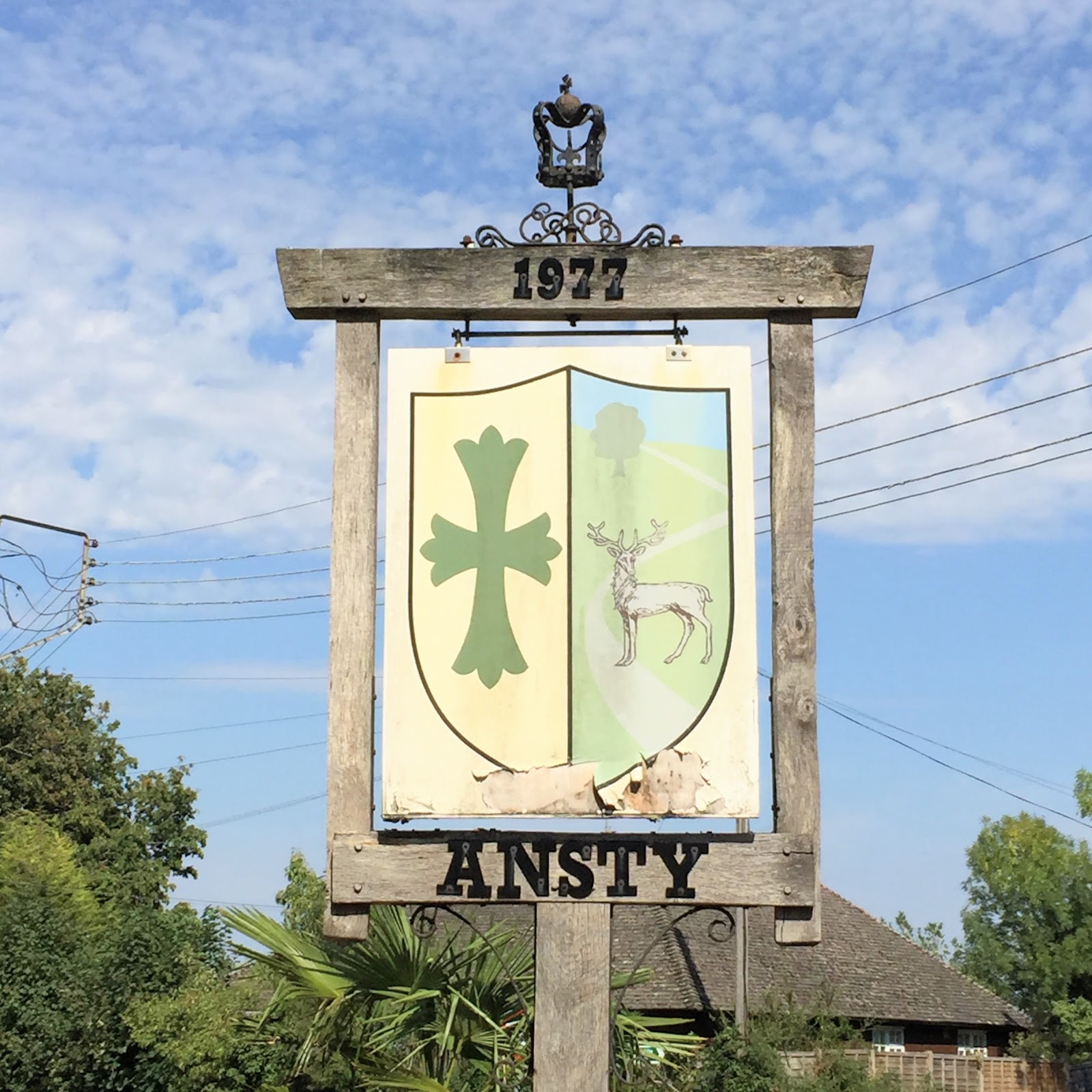
Sussex place names can be tricky to pronounce. When people mention them they betray their familiarity or unfamiliarity with the locality. Ansty like Ardingly is pronounced with heavy stress on the last syllable i.e. An-stye. Haywards Heath commuters are most familiar with Ansty as the fastest way in and out of the town from the A23 London to Brighton Road. This walk across the fields from Haywards Heath is a discovery of the hamlet for itself beyond its significance on the fast road out of town. There is a petrol service station for refreshments before catching the Horsham bus back to Haywards Heath. Walk straight out of town from Muster Green along Butler’s Green Road. You pass in front of two historic buildings mainly concealed by hedges mentioned on the 1638 Hayworth map. Steeple Cottage is named there as the then Court House. Butler’s Green House was home from the 17th century of the Warden family whose name has been applied to the local Warden Park schools. After the roundabout, cross the road and take a left turn down Copyhold Lane following the public bridle way sign past Lodge Farm. Take a right turn at Copyhold Cottage then continue left as a path joins from your right. Go through a gate and follow the path down to a bridge over the stream. Ascend the steps after this, turning left onto a gravelled track. Follow this track to Birch Trees Farm and the A272. Catch the 89 bus back to Orchards.
Wakehurst’s Millennium Seed Bank (2000) is run by Kew Gardens who collaborate with the National Trust in providing public access to the Bank alongside the Tudor mansion (1590) and extensive gardens owned by the Trust but managed by Kew. The Bank collects and conserves seeds from all of the UK's native flora and much of the world's flora to save species from extinction in the wild. The gardens are among the largest in the UK at 490 acres. An early 20th century creation they include walled and water gardens, woodland and wetland conservation areas. In among the trees stand a handful of bare trunks deriving from the great storm of 1987 which made havoc across Mid Sussex. Dead and hollow they were kept deliberately and serve as bat roosts. Wakehurst has the largest growing Christmas tree in England, a 35 metre (115ft) redwood lit in season by 1,800 lights. A good walk to Wakehurst heads past Haywards Heath Fire Station crossing College Road up Wickham Lane and across the fields and golf course to Copyhold Lane. Across the Lane diagonally to the right is the footpath through River’s Wood to the Reservoir where you enter the waterside walking trail which starts with a wooded section. After this take a right turn going over a style. Walk up the fields into Church Lane, Ardingly. At the top is St Peter’s Church. Turn right then left into the Showground footpath which continues alongside the grounds then further north to Wakehurst Place. Catch the 272 bus back to Orchards.


Former Prime Minister Harold Macmillan and his wife Dorothy lived at Birch Grove House outside Horsted Keynes and were well known in Chelwood Gate, Danehill, Forest Row and Horsted Keynes. Macmillan combined his national role with hunting, shooting, reading theology and attending St Giles, Horsted Keynes sometimes twice on a Sunday. When one of his most famous visitors, President John Kennedy, was assassinated in 1963 he insisted the reading in St Giles the following Sunday be changed to ‘Let us now praise famous men [sic]’. Kennedy attended Mass in neighbouring Forest Row months before his death. Macmillan’s own death brought drama to Horsted Keynes. On funeral day sharp shooters were placed on the roofs in Church Lane to guarantee the safety of Macmillan’s more turbulent successor, Prime Minister Margaret Thatcher who led a contingent of celebrity mourners in St Giles. To walk to Birch Grove head from Haywards Heath to Horsted Keynes by 270 bus and walk down to St Giles Church where the Macmillan grave is found with its Celtic Cross beyond the yew tree at the east end of the building. From the village green walk keeping the Green Man pub to your left. Go round the left bend continuing along Birch Grove Road past Westall House, carefully round a sharp left bend and then gentler right bend. Continue the more or less straight country lane which passes Birch Grove House on the right. The road bends right after crossing Danehill brook continuing to the A275 Lewes Road. Catch the 270 Orchards bus back to Haywards Heath from outside the Red Lion pub on this road junction.

Tracing the rainbow through the rain at Walstead Cemetery. I love autumn’s ‘special effects’ when the sun shines near horizontal in the late afternoon. Fortunately the rainbow was the main consequence of the rain which otherwise didn’t subtract from my walk along the lanes that radiate from Haywards Heath. More at https://lifeinhaywardsheath.blogspot.com.


Stumbled on this ‘tree’ walking from Whitemans Green down to Horsgate Lane and The Wheatsheaf in Cuckfield. I had to divert briefly from a really muddy stretch into and out of a copse where this ‘triffid’ seemed to take a dislike to my diversion. As you can see the vertebrate feel of it is accentuated by what seem to be feet! My ‘tree’ also has the feel of an octopus standing to attention. What is it that makes trees like this, close to John Wyndham’s imagined ‘triffid’ trees? Even Mr Google seemed stumped by my query!

hi there i had to do shoping in sainsbury de last 3 weeks as my wife is away for 8 weeks i noticed that half of the staff no mask i phoned sainsbury complain department not much help so i told the lady i will get in touch with the counsel she said please dont i had more complaints but i was able to clear these there i think in this day and age with corona
ReplyDelete